Tuesday, 14 February 2017

The Ita Fort at Itanagar was built in the 14th or the 15th century. It is said that the city of Itanagar got its name from the fort itself. 
The fort is built in an irregular shape by a king of Jitari dynasty, Ramachandra. It is believed that 80 lakhs of bricks were used for constructing the structure of the fort.
The fort has three different entrances at three different sides, which are western, the eastern and the southern sides. 
Apart from exploring this fort on foot, one can visit Indira Gandhi Park, which is at a distance of about 2 kms from here.
How to Reach
By Rail: The closest railroad station is Harmuti in Assam. It situates at a separation of 55 km from Itanagar. There are regular taxi administrations from Harmuti to Itanagar. Therefore, Harmuti very much associates with different urban areas in the North East.
By Bus: Itanagar has a decent street system. There are overnight express transports which associate Itanagar to Guwahati. Aside from that, the Arunachal State Transport Corporation run government transports interface Itanagar to different urban communities in the North East too.
By Air: Lilabari in Assam is the closest airplane terminal to Itanagar. Found 68 km from Itanagar. Lilabari very much associates with flights from Guwahati.

Ita Fort,Arunachal Pradesh,India

Sunday, 12 February 2017

At an elevation of 5,000 m above the sea level, the Bum La Pass marks the Indo-China border. A prominent attraction of Arunachal Pradesh, the place is a must visit but only when you have the special permit from Office of the Deputy Commissioner in Tawang District, and then Indian army cantonment of Tawang. 
The place instantly evokes a feeling of patriotism, especially after watching soldiers protecting the border that too in such nerve-wracking weather condition. Also, it was through this pass, Dalai Lama entered India.
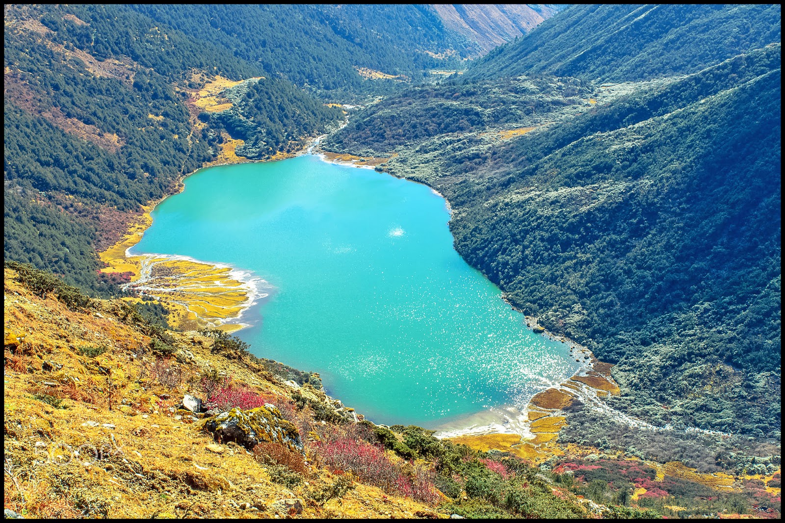
When on a visit to Bumla Pass, make a point to see the route from where Dalai Lama entered India to take a refuge. Also, there's a lake called Sangestar Tso, which is worth a watch.
You can also see the Indo-China Border Personnel Meeting (BPM) Point, which is one of the four meeting points between Indian Army and People's Liberation Army of China for regular consultations and interaction.
How to reach 
Tezpur in the nearest airport. After reaching Tezpur one can hire a cab for Tawang( costing around 5k) or share a cab with others( 1500 each). A trip to Bum La costs 2000 rupees for a Tawang-Bum La-Tawang trip. It is noteworthy that Arunachal Pradesh is closed for foreigners and Indian citizens need a inner line permit to enter the state.
For going to Bum La, permit should be taken from the DC office, and the same has to be stamped in the cantonment of Tawang. Please note that without the army stamp, you will not be allowed through the numerous check posts on the way. The army cantt. is open for civilians after 5 pm weekdays. 
Bumla Pass is reachable only by road, after receiving special permits. It is 37 kms away from Tawang. From Tawang to Y-junction is a 22 Km distance which has a metalled road, the rest 15 Kms are gravel road. This road is one of the shortest connectivity points to China from Tawang (India). On the Chinese side, the nearest major town Tsonajong is 43 Kms from Bumla border post.

Bumla Pass- Arunachal Pradesh - India

Friday, 10 February 2017

Also known as Jang falls or Bong Bong Falls, Nuranang waterfalls are located around 40 km from Tawang town. These waterfalls are placed at an elevation of around 6000 feet and are one of the most stunning waterfalls in Arunachal Pradesh state. 
The locals believe that this milky white waterfall has been named after Nura, a Monpa tribal girl who probably helped an Indian soldier by supplying arms and also gave shelter to him at the time of Indo-China war. 
One of the most spectacular waterfalls in the country, the Nuranang Falls are a beautiful white sheet of water that descends from the height of about 100 meters. 
Nuranang waterfall has crystal clear water which elevates your spirits and encourages you to indulge in swimming. 
After visiting the falls, you can also pay a visit to Hydel power station, which is placed nearby. Regular bus service is available from Tawang to reach Nuranang falls. 
How to reach
​Reaching the location through road is the only mode of transport. Tawang is the best destination to reach Nuranang. Tawang is easy reaching location of AP and countless buses are available from various parts of the state.

Nuranang Waterfall- Arunachal Pradesh - India

Wednesday, 8 February 2017

Located in the Tawang-Chu river valley, in Arunachal Pradesh, India, at an elevation of 3300 meters, the wonderful Tawang monastery is one of the most important and largest Buddhist shrines in the world. 
This holy shrine, located in the midst of majestic mountain ranges, is home to more than 700 monks and 450 Lamas, making it the biggest Buddhist Monastery in India, and the second biggest in Asia, outside of Lhasa, Tibet.
Losar and Torgya are the popular festivals celebrated in the monastery. Celebrated in February, the Losar festival marks the beginning of the New Year. This 15 day festival is celebrated by lightening lamps, hosting prayer flags and offering prayers.
The best time to reach Tawang Monastery is in between April to October. One can also visit during the time of Losar festival which is in between February and June.
Tawang monastery is one of the most important Buddhist shrine located in a scenic backdrop in the lap of the majestic mountains and is worth visiting at least once in a life-time.
How to Reach
By Air: The nearest airport is at Tezpur (Assam), which is at a distance of 365 kilometers. Tezpur is directly connected to Kolkata (West Bengal) by two flights weekly. Another option is Guwahati (Assam) which is 555 kilometers away from Tawang and is connected to different parts of the country by daily flights. 
By Train: Guwahati, located at about 555 km from Tawang has the nearest rail station, which is also connected to all the major cities in India. 
By Road: State transport and private bus services are available to reach Tawang. Commercial taxi services are also available. The nearest bus services are from Bomdila (185 km), Tezpur (365 km) and Guwahati (555 km). 
Book your Tawang Monastery Holiday with our affiliate partner Booking.com

Tawang Monastery- Arunachal Pradesh - India

Monday, 6 February 2017

One of the most breathtaking places in the Himalayan vista, Sela Pass is a lifeline for the people of Arunachal Pradesh, and the Sela Lake is as heavenly as it gets. The two combine to enchant one and all by their mystic beauty. 
One of the most stunning gifts of nature to the North-East, Sela Pass is a lifeline for the people of Arunachal Pradesh as it is the only way that connects Tawang district of the state to the rest of the country.
Besides its geographical importance, Sela Pass is breathtaking place always covered in snow providing some beautiful views of the eastern Himalayan range.
The beautiful Sela Lake is located close to the Sela pass. It is a heavenly crystal blue water lake surrounded by snow-clad mountains. This lakes remains frozen during winter season.
How to reach
By Air
Nearest airport from Tawang is located in Tezpur (Salonibari Airport) at a distance of 387 km. The airport is directly connected to Kolkata and Guwahati through Air India flights. In October 2014, Government of Arunanchal Pradesh Government started helicopter facility to connect Tawang and Guwahati. The service is available twice a week.
By Road
Best way to reach Tawang through road is via cab or bus services. Arunachal Pradesh State Road Transport Corporation (APSRTC) and other private agencies have introduced regular bus services, 
By Train
Nearest railway station from Tawang is Rangapara Railway Station, at a distance of 383 km. It is well connected to major cities and towns of North-east India. About 88 stations are directly connected to Rangapara Railway Station.

Sela Pass- Arunachal Pradesh - India

Saturday, 4 February 2017

Also known as Gentse Gaden Rabgyel Lling monastery, Bombdila monastery was built in 1965 by the twelfth incarnation of the Tsona Gontse Rin poche. And was rebuilt by the thirteenth reincarnation, Tsona Gontse Rin ponche renovated the monastery by building a larger prayer hall.
The monastery was inaugurated in the year of 1965. This monastery is considered to be same as that of the Tsona Gontse monastery which is in Tibet.
The monastery has three layers- The Upper gompa, middle gompa and the lower gompa. There is also a huge prayer hall made where the monks and lamas and other visitors offers their prayer. Apart from these the monastery also has quarters for the monks and they also have school where the young monks are taught about buddhism and other subjects.
Apart from its religious significance, the monastery is also known for its natural beauty. Stunning vistas that you can see from here are fabulous and breathtaking.
The best time to plan a visit to plan a visit to the monastery will be during the Losar Festival, which is commemorated to mark the new year.
How to Reach
By Air:
Tezpur in Assam is the nearest airport. Located at a distance of 160 kilometers from Bomdila, this airport is connected to all major cities of India.
By Road:
Bomdila is easily accessible from Guwahati (338 kms) and Tezpur (153 kms) with well-connected roads and mesmerising views on the way. However, being a hilly route with a number of hairpin bends, it is advisable to go with an experienced driver or take one of the Arunachal Pradesh State Transport Company or Assam State Transport Company buses. 
By Train:
Rangapara railway station in Assam (144 kilometers from Bomdila) is the nearest railway station, with frequent trains to a number of locations.
Book your Bomdila Monastery Holiday with our affiliate partner Booking.com

Bomdila Monastery,Arunachal Pradesh,India

Thursday, 2 February 2017

Namdapha, a Tiger Reserve and National Park, a true wilderness and enchanting beauty of lush green vegetation, impenetrable pristine and virgin forests covered an area of 1985.23 square kilometres having diverse flora and fauna lies in the international border between India and Myanmar(Burma) within Changlang District in the state of Arunachal Pradesh in the northeast India.
The lush green under growths are thick and intertwined like cobwebs of canes, bamboos, wild bananas and variety of vegetations The grandeur of the wet tropical rain forest is breeding ground for varieties of animals and birds which is remarkable and worth seeing.
The nearest town is Margherita which is 62 km from the national park. The national park is famous for its wonderful varieties of spices and vegetation. It will be a wonderful holiday with nature and her various forms.
The cold weather and the stability of the temperature give the animals to have comfortable days. Being a hilly area the place always remains crowded with colorful birds and their vivacity.
Apart from bird there are Elephant, Wild Goat, Gibbon, Assamese Macaque, Mongoose, Musk Deer, Takin, Goral and a large number of rodents like squirrels, porcupine and Mithan.
How to Reach
By Air
The nearest airport to reach the Namdabha National Park is at Mohanbari, Dibrugarh in Assam at about 182 kms away. Guwahati Airport in Assam is the nearest International airport.
By Rail
The Namdabha national park can be reached by from the major cities of India through the nearest railway station from here at about 141 kms in Tinsukia, Assam. The nearest passenger railway station is about 91 kms away from here in Margherita, Assam.
By Road
It is well connected with roads upto Miao which is the entry point of Namdabha and to Tinsukia, Dibrugarh and Margherita which are about 141 km, 186 kms and 91 kms respectively.

Namdapha National Park,Arunachal Pradesh,India

Tuesday, 24 January 2017

The meaning of Rang ghar is an Amusement house. Ahom kings of Assam had constructed this important and famous amusement amphitheater. The Rang ghar building has two floors. Often The Royal family used The Rang ghar building for the witness various games which was organized during the celebrations of Rangauli Bihu with the adjoining of Rupahi Pathar.
The architectural structure of Rang Ghar is one of the oldest structures of Assam. The structure has a great importance for historians as well as architects as it shows the architectural taste of that time. The structure has been built on lines of the royal boat Ahom. The shape of the roof of the Rang Ghar resembles the same. A pair of crocodiles made up of sculpted stones is found on the roof of the Rang Ghar.
Series of entrances are built at the base of Rang Ghar. The Ahom people were not aware of mortar and cement in those days, hence it has been constructed with mixture of eggs and rice along with baked bricks. The inner surface of Rang Ghar has been lined using the powdered lime with bricks.
Often referred to as the Colosseum of the East,Rang Ghar is one of the oldest surviving amphitheaters of Asia. It is located near Rangpur Palace at a distance of 3 km from Sibsagar town. The name translates to House of Entertainment and dates back to 1746 A.D.
Owing to such rich historical importance, Rang Ghar was used as a logo for the 33rd National Games held in Assam in 2007. Presently, the condition of this monument is fragile. 
How to Reach
It is located near Rangpur Palace at a distance of 3 km from Sibsagar town.
By Air
There is no airport in Sibsagar itself but, the nearest airport to the place is the Jorhat Airport which is located at a distance of around 67 km from the city. The airport is well built and connected to many major cities of India like Banglore, Mumba and Delhi. From the airport, you can easily hire a taxi to reach Sibsagar within two hours.
By Train
There is a railway station in Sibsagar called Sibsagar Town Railway Station which is closely located at a distance of 2 km. It is well connected to nearby cities like Guwahati through regular trains. From the station, you can easily walk or hire a taxi to reach the city within ten minutes.
By Road
Sibsagar is readily available via a good network of road transport. There are regular bus services that operate between Sibsagar and nearby cities like Guwahati. However, bus connectivity from some towns is infrequent. Alternatively, many taxi services ply which connects the place to neighboring cities.

Rang Ghar,Assam,India

Sunday, 22 January 2017

Home to the endangered Great Indian one-horned rhinoceros, Pobitora Wildlife Sanctuary is located in the Morigaon district of Assam. Boasting of the highest density of Indian rhinos, the sanctuary is 50 km east of Guwahati. Pobitora along with Kaziranga National Park and Manas Wildlife Sanctuary form the three most important reserves for the protection of Indian rhinos. 
The Wildlife Sanctuary which is spread over an area of just 38 sq. kilometers is a small, heavenly segment of raw wilderness and greenery. The refreshing breeze of the lower Himalayas, the greenness and calm of the sanctuary and the thrill of being one with nature is enough to tempt anyone for a visit to this amazing place. The dense population of Rhinos allows one a greater chance of sighting the endangered creature while on Elephant or jeep safaris.
Legend has it that the King of Mayong gave the name Pobitara to the forest after his lovely daughter who died in her youth. In 1971, the forest was declared a reserve forest to protect the famous rhinos. In 1987, Pobitora was declared a wildlife sanctuary.
Animals like the Asiatic buffalos, leopards, wild bear, civet cat, etc. are found in the sanctuary. The sanctuary is also an ideal for bird watching. It consists of more than 2000 migratory birds. Several resident and migratory birds such as Indian pied horn bill, osprey, hill myna, kalij pheasant, etc. are found in the reserve.
Due to its rich birdlife, the sanctuary is also called as the ‘Bharatpur of the East’. Various species of reptiles like Indian python, common monitor lizard, Indian tent turtle, Indian cobra are also found in the sanctuary.
The nearest accommodation to Pobitora is at its own entrance on the west side of the sanctuary which is government owned. Other accommodations are available in the Mayang Village, nine km north of Pobitora Wildlife Sanctuary. Tourists prefer to stay at Guwahati, where a range of luxury and budget hotels are available. There are no eating options in the sanctuary. Fish is a major delicacy in Assam and one can find lip-smacking food at cheap rates in Paltan Bazar. The best time to visit the sanctuary is between November and March. Visiting the sanctuary during the monsoon season is not advisable.
How to Reach
ByAir: Flights are available for Guwahati from all major domestic airports in India. From there, you can hire a cab till Pobitora Wildlife Sanctuary.
By Rail: The nearest railhead is at Jagiroad which is well connected to Guwahati. From Jagiroad, you can take public buses or a cab.
By Road: From Guwahati, Pobitora is a 2 hours ride via a narrow road. If coming from Kaziranga on NH 37 take the route for Mayang at Jagiroad. Buses are available from Adabari Bus Station in Guwahati till Chamata. From Chamata catch a public bus for Kolangpur and take an auto rickshaw to the Sanctuary. Alternatively, you can take a bus from Guwahati till Morigaon and a bus from Morigaon till the Sanctuary.
Book your Pobitora Wildlife Sanctuary holidays with our affiliate partner Booking.com

Pobitora Wildlife Sanctuary,Assam,India

Wednesday, 18 January 2017

Manas National Park or Manas Wildlife Sanctuary is a Wildlife Sanctuary, UNESCO Natural World Heritage site, a Project Tiger Reserve, an Elephant Reserve and a Biosphere Reserve in Assam, India. 
The name of the park is originated from the Manas River, which is named after the serpent goddess Manasa. The Manas river is a major tributary of Brahmaputra River, which passes through the heart of the national park.
The park was originally spread across 360 sq kilometers upon its establishment in 1985, but after been expanded in the subsequent years it now spreads across 950 sq kilometers and spreads across 5 districts in the state of Assam.
The park is placed along the eastern Himalayan foothills and comprises of marshy grasslands and thick monsoon, sub-Himalayan Terai and mountain forests. The park enjoys a favorable climate all year round with heavy rainfall during the monsoons.
While it is best to avoid visiting the park during heavy monsoons or summer due to the unfavorable climatic conditions, the Manas National Park is open all year round. The best time to visit is between the months of October till February when the climate is the most pleasant and fauna activity is the highest. The winters in Manas National Park are mild and temperatures rarely go beyond 25 degrees making the park a perfect location for a wild winter getaway.
How to Reach
By Air
Lokpriya Gopinath Bordoloi International Airport, located in Guwahati, is the nearest airport. This airport is located at a distance of around 145 km from the national park. Guwahati is well connected with other parts of the country via air. You can take a taxi from the airport to take you to the park.
By Road
Manas is accessible from Guwahati (176 km.), Kaziranga (403 km.), Darjeeling (466 km.), Shillong (287 km.) and Siliguri (386 km.) by road.
By Train
The closest major railway station is Guwahati, however, you can take another train from Guwahati to Barpeta Road Railway Station, which approximately 44 km away. From Barpeta Road Railway Station, taxis are easily available to take you to the park.
Book your Manas National Park holidays with our affiliate partner Booking.com

Manas National Park,Assam,India