Thursday 25 September 2014

Daulatabad  is a 14th century city, 16 kilometers northwest of Aurangabad  Daulatabad was once as known as Deogiri  when it was an important upland city surrounded with caravan routes connecting up the hill forts. 
The Daulatabad fort is a rare kind of construction, a combination of three fortifications and two moats. The imposing fort was built on a huge isolated pyramid-shaped natural hill. Access to the hill top was again disrupted by slicing down the periphery rock till the ground level leaving a steep edge around the hill.
The fort area is surrounded by three concentric walls or fortifications. The outer one called Amberkot covers a diameter of about 1.5 Kilometers and it includes the half kilometer long Daulatabad town. The National Highway NH 211, connecting Aurangabad to Ellora (Ellora Caves) passes inside Amberkot.  The second fortification is Mahakot which enclosure the Chand Minar and the foot of the hill.  Mahakot has eight gates around it and is surrounded by a deep gully which is dry right now.
Located 15 km away from the main city of Aurangabad, the fort of Daulatabad in Aurangabad is no less than an architectural and engineering marvel, which is why it is counted amongst the 'seven wonders of Maharashtra'. Built in the 12th century, it is one of the most powerful fortresses of the medieval period. It is built on a 200 mt high conical hill, which provides this grand fortress a strategic position, architectural beauty and protection from the enemies.
The town of Daulatabad was once known as 'Devgiri' meaning the 'the hill of gods'. The entire township of Daulatabad was developed by the King of Yadava dynasty, Raja Bhillamraj Yadav in the year 1187. The main constructions of the town include both Daulatabad fort and Devgiri fort. The fort is considered among the best-preserved forts in the country which has survived several years without any alteration. 
How to Reach
Daulatabad is 15 km from Aurangabad which is well connected by road to all major cities.
By Air: Nearest Airport is Chikalthana,12kms from the Aurangabad city and 30kms from Ellora. Indian Airlines connects Aurangabad with Delhi and Mumbai (388 km) daily. 
By Rail: Aurangabad is directly linked to Mumbai and Pune. Jalgaon, the nearest railhead on the Central Railways line, is 59 km from Ellora. Two trains Tapovan Express and Devgiri Express depart daily from Mumbai to Aurangabad.
By Road: State buses run from Mumbai (392km), Pune, Ahmednagar, Jalgaon, Shirdi, Nasik, Dhule, Ahmedabad, Hyderabad, Indore and Bijapur to Aurangabad. Maharashtra Tourism Development Corporation (M T D C) operates conducted tours from Mumbai, Jalgaon, Aurangabad etc.
Book your Daultabad holidays with our affiliate partner Booking.com 

Daultabad Fort - Maharashtra - India

Wednesday 24 September 2014

Rajmachi is a small village situated in the Sahyadri mountain range of the Konkan region of Maharashtra. Rajmachi has two fortified peaks - Shrivardhan and Manaranjan forts, located near two famous hills of Lonavala and Khandala.
At the base of the fort is the village Udhewadi which is another name for Rajmachi. Rajmachi has seen many change of hands from Shivaji Maharaj, Emperor Aurangzeb, Shahu Maharaj and eventually the British reign.
The height of this fort 2710 Feet . This fort built by Shivaji in 17th century. You can spend lots time over the fort by exploring  Manranjan ,Shrivardhan, Rajamachi lake .There are 2 routes are there first from  Karjat and from lonavala  Karjat route is comparatively difficult than Lonavala. 
Between the peaks, there is a small plateau that connects the Manaranjan and Shrivardhan Peaks. Known as 'Bale killa', the fort that is positioned atop the Shrivardhan Peak has an elevation of 3,000 ft. Built to monitor the activities in the Konkan Area, the fort enables tourists to get an aerial view of Rajmachi.
In addition to having an eventful history, the twin forts of Rajmachi have earned recognition for their brilliant architecture. The fort complex consists of huge ramparts, strong walls, massive gateways, residential units, water reservoirs, administrative centers and secret gates for exit.
Rajmachi Fort offers an aerial view of the Duke’s nose, Matheran and the Ulhas River, and also that of the old caves at Kondhavi and Tungarli Lake.
Rajmachi Fort is nestled amidst picturesque surroundings, which make it an apt venue for photography. The architecture of this fortified twin structure specially attracts those who have interest in archaeology and history.
How to Reach
  • By Road: Lonavala is less than 2 hours from Mumbai and Pune. You get regular buses / cabs to Lonavala throughout the day;
  • By Rail: Nearest railway stations are Pune & Mumbai, both less than 2 hours from Lonavala by road. Both Mumbai and Pune is very well connected to rest of the country by rail;
  • By Air: Nearest airports are Pune & Mumbai, both less than 2 hours from Lonavala by road. Both Mumbai and Pune is very well connected to domestic and international destinations by air
Book your Rajmachi holidays with our affiliate partner Booking.com

Rajmachi Fort - Maharashtra - India

Tuesday 23 September 2014

Visapur fort is located in the Visapur village of Lonavala which comes in Pune district of Maharashtra state of India. It is located at an altitude of approximately 3500 feet above sea level. It is located at a distance of about 15 km from Malavli railway staion in Lonavala. 
The Visapur fort was built by Balaji Vishwanath-the first Peshwa to Chhatrapati Shahu Maharaj in the earlier 18th century A.D. Chathrapthi Shivaji was using this as a place to watch the movements in the downhill and the plains.
The mountain of Visapur is significant, as Bhaje caves have been carved out in the same mountain. The destruction caused by Mughals and English is clearly evident from the injuries on the Bhaje caves. These beautiful caves could have been bombarded by cannon balls, because much of their part has been broken.
Other things that add to the uniqueness of the fort are constructions like the bastion on the western side of the fort. This bastion, unlike others is completely within the main ramparts. Such a construction is rarely seen on other forts. The other remnants include old residential places. There is a fountain on the northwestern side.
It is situated on the east side of the Lohagad Fort and Bhaja Caves. It is a major trekking attraction especially in the monsoon season. This place is around three hours drive from Mumbai and around one hour drive from Pune.
How to reach :
From Pune
 Catch local train going toward Lonavla. Alight at Malvali. Trek starts from here.
From Mumbai
You need to reach at Lonavla. From Lonavla, catch the train going towards Pune. Alight at Malvali.

Visapur Fort - Maharashtra - India

Monday 22 September 2014

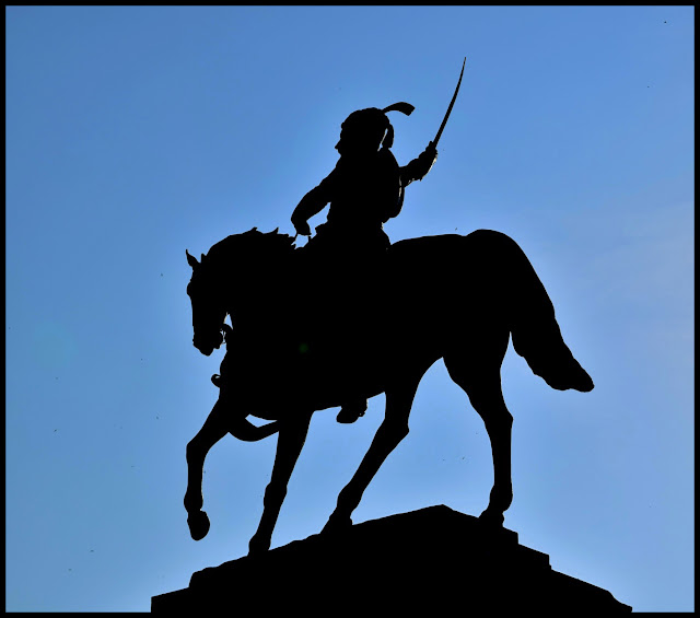
Shivneri, a birth place of Chhatrapati Shivaji (1627), is located at a distance of around 3 km from Junnar (125 km from Pune). Shahaji, father of Shivaji kept his wife Jijabai in this fort during her pregnancy, as the fort was unique and difficult to reach. It is easier to reach the fort by the normal road than to climb from the hills. One has to get through 7 doors before reaching the actual fort. 
This fort is a very big structure with a very good height. The old and beautiful 'Devi Shivai' temple is on the way. Shivaji was taken from the name of this goddess. Shivaji spent his childhood on this fort. He acquired all the skills and training on this fort which he used while establishing Swaraj. He learnt the early lessons of Swaraj on this fort.
The wide base of the fort is towards the south and the narrow point is towards the north. The ascending path to the fort is defended by seven gates, the fifth one being armoured with anti-elephant spikes. The fort has several rock-hew cisterns and ponds, of which two large ones are known as Ganga and Jumuna. 
Today, there are only a few structures remaining in the fort. At one end there is a ruined stable and at the other end a mosque of the Mughal period. The house where shivaji was born (in February, 1630 AD) has been recently restored and a temple with statues of Shivaji and Jijabai called Shivakunja, has also been built.

The Shivneri cluster forts, comprising Harishchandragarh, Jumnar, Jivadhan, etc. was very important strategically, because it controlled the ancient Nane Ghat Pass.
How to Reach
By Air
The nearest airport to reach Shivneri fort is at Pune Airport which is situated around 10 kilometers from the city in Lohagaon area. The Indian Airlines operates regular domestic flights that pass through various major cities of India like Mumbai, Bangalore, Chennai, and Delhi. For international tourists, they can connect first reach to Mumbai International Airport and then board a domestic flight for Pune city. From airport you have to catch taxi to reach at Shivneri fort, but it could cost you little expensive.
By Rail
The nearest railway station is Pune Railway Junction, it is the main railhead which offers good networks on rails that connects other cities in India. There are many trains and expresses that are available from Mumbai, Delhi, Bangalore, Chennai, and many more. For reaching Pune, Deccan Express is one of the fastest trains that depart from Mumbai Railway Junction.
By Road
There are many road transport facilities available to get at Shivneri fort. Regular state bus and private luxury bus services are provided to and from Pune which passes through numerous major cities of India like Hyderabad, Mumbai, and Goa. From Mumbai city, it directly links Pune at a distance of 200 kilometers. You can pick these buses from outside railway station or airport. Apart from bus, visitors can also travel by taxi, auto rickshaw, hired cars, which may cost you expensive to reach the fort.

Shivneri - Maharashtra - India

Sunday 21 September 2014

Pratapgad is situated in Satara district, Maharashtra, India and is 25 km from Mahabaleshwar. The fort is considered to be the highest point of the range with a full view of the surrounding places. 
The main purpose of construction of the Pratapgad fort was to defend the banks of the Nira and the Koyna rivers, and to defend the Par pass by Shivaji. Construction of the fort was completed in 1656.
From a distance, the fort looks like a round tipped hill with the walls of the lower fort giving the impression of the fort being a crown on the hill. Further fortification of the fort was later authorized by Shivaji and done by Moropant Pingale, the first Peshwa or the chief minister of the Maratha Empire
The fort can be divided in to two parts, upper fort and lower fort. The upper fort was built on the summit of the hill. The layout of the fort forms a crude square and the walls stretch for approximately 590 sq ft on all sides. You can get stunning views of the Raigarh Fort and coastal Konkan from the top of the Pratapgad Fort.
Revering the valour of the warrior Shivaji, a 17-foot high equestrian bronze statue of Shivaji was unveiled by Jawaharlal Nehru, the first prime minister of India in 1957. This statue of Shivaji can still be seen while climbing to the Pratapgad at the beginning. The fort is currently owned by Uday Raje Bhosale, the heir of the Satara princely state.
You can plan a trip to Pratapgad any time of the year but monsoons are the ideal time to visit the Pratapgad fort to experience the real greenery of the place.
How to Reach 
Mahabaleshwar is located in Satara district and is almost a converging point from 3 main cities of Maharashtra - Mumbai Pune and Kolhapur making mahabaleshwar a very busy hillstation in Maharashtra! Being a hillstation there is no rail head in Mahabaleshwar and the best way to travel to Mahabaleshwar is roadways.
Best Route from Kolhapur to Mahabaleshwar
Kolhapur - Karad - Satara - Wai - Panchgani - Mahabaleshwar
Best Route from Mumbai to Mahabaleshwar
Panvel - Mahad - Poladpur - Pratapgad - Mahabaleshwar
Best Route from Pune to Mahabaleshwar
Pune - Surur - Wai - Panchgani - Mahabaleshwar
Book your Pratapgad holidays with our affiliate partner Booking.com 

Pratapgad - Maharashtra - India